One of the most common units for all beginner Spanish classes is the travel unit (or a Spanish geography unit). And, how do we usually introduce the topic of travel to our students? With the Spanish speaking countries and capitals. This year, I will be introducing Spanish geography with the countries and capitals during the first few lessons of my Spanish 1 travel unit. I wanted to share with you some of my favorite games and activities to teach countries and capitals. And, if you like the activities mentioned below, get over 80 pages of maps, games, and activities for only $5.00 here!
The first activity that I do is an informal pre-assessment. I always like to see what my students know on a topic before we dive into it. In this case, students will create a list of all of the Spanish-speaking countries they already know. Even if they can name a majority of the countries, that doesn’t mean they know where they are on a map, or even the names of the capitals. You’ll still have plenty of Spanish geography to teach them!
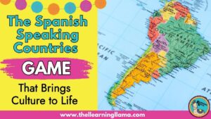
Spanish Speaking Countries
To begin, focus just on identifying the countries on a map. Don’t try to cover countries and capitals right away. Add the capitals after a few games or even a couple of days. Try any of these Spanish geography activities to teach countries.
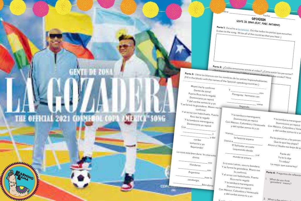
La Gozadera Song
Students love music! This catchy, upbeat song “La Gozadera” by Marc Anthony is a great way to have students begin listing all of the Spanish-speaking countries in Latin America. Plus, the music video is fun and helps students understand that “gozadera” means a party and that all Latin American countries are united through their language and culture.
As your students listen, provide a cloze listening activity where students fill in the blanks of the lyrics (just the names of the countries). You’ll probably need to play the song a few times for students as they complete the worksheet. Capitals are not mentioned in this song, which is why I like to use it at the beginning of the unit, as we are just focusing on naming countries.
Info Gaps
Students each get a map, but one student has specific countries marked off, and the other student has different countries marked off. They must describe the country to their partner without saying its name. They can only use directional words (north, south, east, west) to help their partner identify their given countries. (El país está al norte de Costa Rica y al sur de Honduras.) As their partner listens, they take notes on a blank map, marking down which countries their partner is describing.
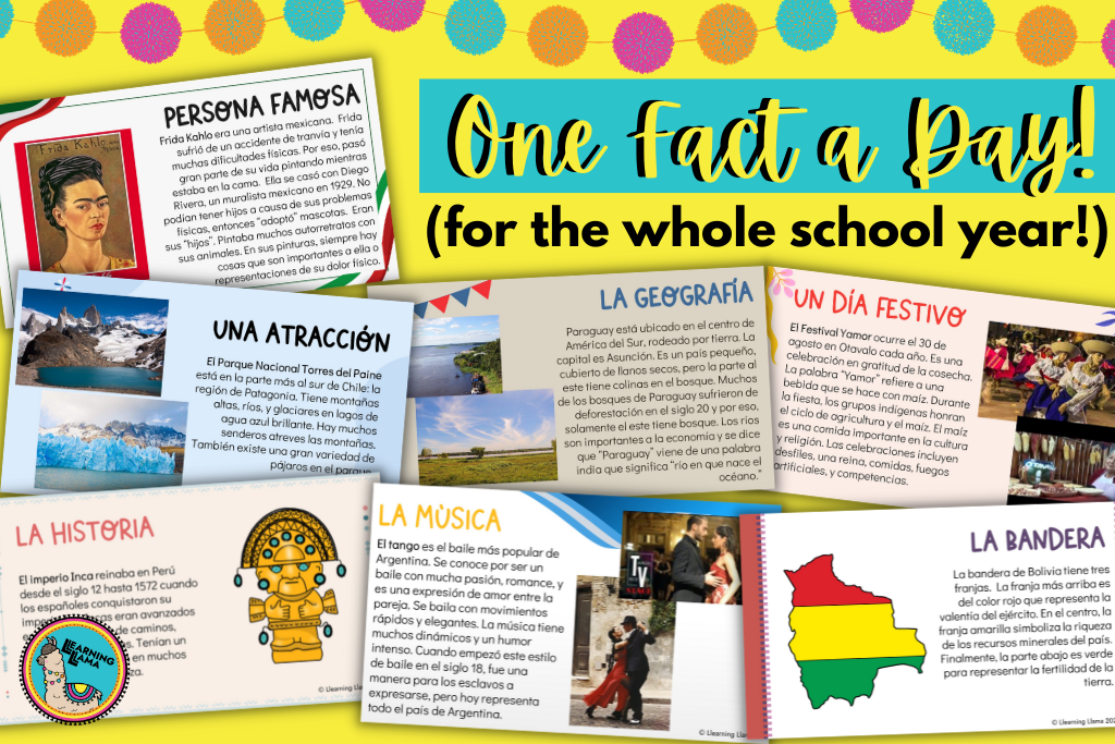
One Fact a Day
There are 21 Spanish-speaking countries. Try sharing one interesting fact per day about each country. Share images and videos that represent these facts. You might consider famous people from that country, a recipe, a dance, geography, etc. I like to incorporate these fun facts as daily Bell Ringers, which could be used all year long to teach about culture and geography! You can get an entire set of 210 facts here or purchase individually for specific country studies.
Quizlet
I have two Quizlet sets that can be used for various games. The first focuses on the countries and the map locations. The second Quizlet set is countries and capitals. My students love playing Blooket, which offers a bunch of interactive games using the vocabulary from your Quizlet list. You can easily import your vocabulary list from Quizlet with just a few clicks. We also play a lot of Quizlet Live, Around the World, matching, spelling games, Pictionary, etc. with Quizlet lists. Check out my blog on why students and teachers love Quizlet here!
Pin the Tail on the Country
I made a large map of Central and South America by placing bulletin board paper on my whiteboard and projecting, then tracing a map of Latin America onto the paper. As a side note, I’ve used the map for 3 years straight now and it is still in great condition! Post this map somewhere in your room. Divide the class into two teams. Create tails out of paper and attach magnets or tape to them. Call out a country and students race to pin the tail on the country! (If you would rather play matamoscas with flyswatters, this would work the same way!)
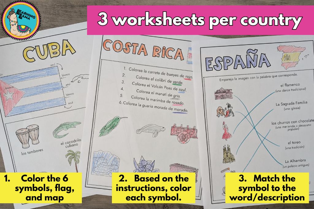
Cultural Symbols
It is not enough just to have students memorize the names of the countries and their locations. We want them to learn a little bit about what makes each country unique and special. I designed a resource that teaches students 6 cultural symbols per country. Then, they get to color the symbols and practice identifying what these symbols are. These worksheets are for very novice students and include a lot of coloring which can be a fun, low pressure lesson! You can also get a physical version of these activities in a workbook!
Spanish Speaking Countries and Capitals
Rock the Capitals Song
Your students will be singing this song for years after they leave your class! No joke! This catchy tune will be stuck in your head all day, but if it helps the students learn and keeps them actively engaged, why not use it!? Here is the link for the Central American countries and the South American countries.
Unscramble the Capitals Race
Create a worksheet with a list of the capitals, but scramble the letters of each capital. For example: evomneitdo would be Montevideo. Whoever unscrambles all of the capitals first is your winner! You can also require students to name the country each capital belongs to in order to make this a bit more challenging.
Concentration/Memory
Write all of the countries and capitals on flashcards. On the back of each card, write a number. Place them all out on a table, but turn them over so students just see the numbers. Then, students will play memory, trying to match the country to the capital.
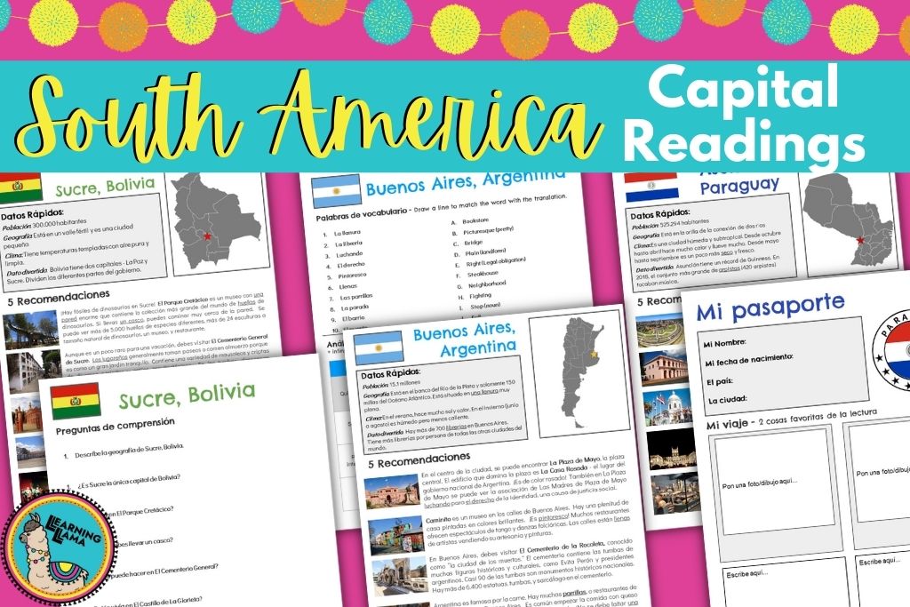
Cultural Readings
If you want your students to learn about the culture, attractions, and geography of each of these capitals, then you have to check out these one-page readings. Each comes with reading comprehension, vocabulary, and a cultural passport activity. You can easily turn this into a project, where each student is assigned one capital to read about and present to the class. As they listen to the presentations, students will complete the passports, and by the end of the project, they will have passports for all of the South American countries!
Virtual Field Trips
Once they learn about where each of the countries and capitals are located, they can “travel” to the countries with a virtual field trip. Take a 360 interactive tour of any location with Google Earth. It is super realistic and students always want to keep exploring! Learn how to use these fun activities in your class. Or, check out the ones I’ve already made. I have quite a few virtual field trips here for countries like Peru, Guatemala, and Chile.
To save you time, you can find most of these resources on my TpT download, complete with over 80 pages of maps, worksheets, and games! There are also detailed instructions and lesson plans for scaffolding instruction. You may also like these worksheets to identify the map, flag, and 6 cultural symbols for each of the Spanish-speaking countries (Digital or Workbook).
There are affiliate links in this post. I may earn a small commission if you choose to purchase from them. Thank you for supporting a fellow educator.